Friday, December 16, 2011

Hydraulic Fracturing Being Blamed for Increasing Frequency of Earthquakes

Youngstown, Ohio is not the first place you think of when the word earthquake is mentioned, and yet, this small town experienced two small quakes this past March, and then seven more in the next eight months. Never in recorded history has this region been connected to seismic activity, and now there have been 9 earthquakes in a year. This is not something people just overlook, or chalk up to nature.

When they plotted the epicenters of the earthquakes they were very surprised to see that they all fell in line with an industrial well along the Mahoning River. This well is 9,000 feet deep and used by a company to dispose of millions of gallons of waste products such as brine, from natural gas wells near by. To harness natural gas, companies employ a process called hydraulic fracturing, which unlocks the gas from shale rock, along with this comes those millions of gallons of liquid waste.

Simply pouring liquid waste into the well might sound like a cop out in the disposal end of the deal, and it might be, but the way fracking is related to the earthquakes is hypothesized to be when the pressure pushes those liquids from the well into deeper rocks and consequently unlocks ancient faults permitting them to slide. Although the chances that this will cause earthquakes around every disposal well and natural gas mine are slim, the increase in natural gas wells is worrisome to many.


http://www.youtube.com/watch?v=73mv-Wl5cgg&feature=player_embedded#!
http://www.nytimes.com/2011/12/13/science/some-blame-hydraulic-fracturing-for-earthquake-epidemic.html?_r=2

Alaskan Storm Surge

Earlier in November of this year a storm riped up the Alaskan coast line. The storm brought sustained wind speeds of 60 mph and gusts of 89 mph. The storm surge on the Chukchi Coast was 6 feet high. Storms of this magnitude are rare in Alaska and it couldn't have come at worse time. In recent years Alaska has been hit hard by global warming affects because it is so far north and is rapidly warming much faster than the rest of the world. Because of this, the sea ice that is usually a buffer between the coast of Alaska and many Bering Sea storms is taking longer to form in the fall, which means its not there when the fall storms set in.

A small village called Shishmaref lies on a barrier Island off the coast and, like the rest of the state, has experienced severe erosion in recent years from higher ocean tides and stronger storms. These effects are appropriately traced back to global warming. The problem the Shishmaref people are facing is an inevitable one, their village is so flat and small, the highest point lies only 10 miles above sea level. If storms like this are to increase in frequency their village will disappear. They are currently raising funds to move their residents from the place they've lived for 4,000 years. Some residents are so angered and frustrated by the issues they are facing have filed a law suit against ExxonMobil and other corporations that have been blamed for polluting the atmosphere and thus accelerating global warming.


http://www.climatecentral.org/blogs/dangerous-storm-threatens-coastal-villages-of-alaska/
http://www.climatecentral.org/blogs/alaska-storm-slamming-already-vulnerable-communities/

Windstorm on the West Coast

Winds have finally subsided out west where a major windstorm has left widespread damage across the region. The windstorm started from a rare combination of a high pressure system in Seattle and a low pressure front in the Southwest that was funneled through the mountains. Wind strengths of up to 167 miles per hour were allegidley recorded in south California near Henniger Flats. This is more than 20 miles per hour stronger than a category four hurricane. Obvious consequences were of toppeled trees, powerlines, and roofs.

There is no deffinate answer as to why thsi rare and epic difference in pressures occured. I find it interesting thought that they do think this traces back to the backbone of what seems to be of many recent natural disasters - Global Warming. A super hazard at its finest, global warming seems to be at work again by altering the time of the year they are at their peak, from fall to winter.


http://www.climatecentral.org/blogs/freak-gusts-during-western-wind-storm/

Tuesday, December 13, 2011

Fukushima Nuclear Disaster Blamed for Contaminated Baby Formula

The Fukushima power plant in Japan experienced Japan's worst nuclear disaster since Chernobyl, on March 11, 2011 after the 9.0 earthquake and subsequent tsunami tore through the country. The power plant was hit hard and ultimately sent plumes of radio active toxins across the country, along with other radioactive waste that may have leaked from the buildings broken structures.

Months later this disaster is being blamed for heightened amounts of cesium found in batches of baby formula. Developing children are particularly sensitive to mutagens especially the effects from radiation. Although the amount of cesium found during these tests was well below the governments safety regulations, a parent isn't going to care about that stipulation.

Media outlets are frequently reporting on the problems Japan's food sector now face because of the March, 11 disasters. Since then there have been heightened traces amounts of radioactive elements in many Japaneses products that were produced within proximity of the Fukushima power plant. Although most of the bans on Japanese food products have been lifted the stigma still continues and so does the number of products being found effected.

The Japanese government  is working to develop technologies to reverse the effects on the surrounding land. A project to be fully launched in January, is working to basically decontaminate the soils within the 12 mile evacuation zone surrounding Fukushima. This will include an attempt to replace all of the top soil in an area roughly the size of Connecticut. Its too early to say whether the tens of thousands of people displaced will be able to return at the completion of this project, or the amount of those people who would want to.


http://globalspin.blogs.time.com/2011/12/07/irradiated-baby-food-spotlights-ongoing-woes-for-japans-food-sector/

Japan's Devestating Tsunami is Named the First "Meged Tsunami"

We all remember the catastrophic earthquake and tsunami that occurred on March 11, 2011, that devastated Japan, with a death toll of up to 16,000 people and entire towns wiped off the map. These events also led to a nuclear disaster at the Fukushima power plant.

Obviously a 9.0 magnitude earthquake followed by a tsunami would tear apart anything in its path, but Ohio state and NASA scientists have recently come out with evidence that explains how the power of these disasters were extraordinary, in the worst possible way. Satellite images were able to capture the tsunami as it began and they show that two massive wave fronts were created by the earthquake, not a single wave as usually occurs. These two waves were pushed together as they hurtled towards shore by underwater ridges and mountains. This phenomenon doubled the size and power of the tsunami and ultimately the devastation it brought to Japan.

Although scientists have suspected an event like this was very possible for decades, they didn't have any hard evidence until now. Three separate satellites happened to be in the right place at the right time to capture the images of the tsunami. From these findings scientists will now be able to better predict, where, when, and at what severity a tsunami will hit, ultimately enabling them to speed up warnings. Although Japan has one of the best tsunami warning systems in the world, less developed countries that are prone to tsunamis can greatly utilize this breakthrough.

http://timethemoment.files.wordpress.com/2011/11/atokata_03.jpg?w=735


Monday, December 5, 2011

Leak at Fukushima

 A 45 metric ton leak of radioactive water was discovered at the Fukushima nuclear plant in Japan on Sunday. Workers discovered the stagnate body of water inside a barrier adjacent to a mechanism that is used to purify sea water that is used to cool the reactors that were damaged in the catastrophic earthquake and consequential tsunami in March. This particular water isn't suppose to be released into the Pacific Ocean but crews are still working on figuring out if any cesium 137 contaminated water reached the sea.

This leak was ultimately caused by the dual disasters that struck Japan on March 11, a 9.0 magnitude earthquake and a subsequent tsunami, that killed 15,000 people. These also caused major damage to the Fukushima nuclear plant and caused worry throughout the country that a major technological disaster would be created, and it was. It was deemed a level-7 nuclear disaster event, but for a long while the plant seemed to be under control. This is one of the few recent events related to that major technological disaster and hopefully it's the last.

http://www.cnn.com/2011/12/05/world/asia/japan-radioactive-water-leak/index.html?hpt=hp_t2

Friday, December 2, 2011

Chevron Oil Spill Of the Coast of Brazil

On November 7th a crude oil platform belonging to the Chevron Corporation, off the coast of Brazil near Rio de Janeiro began leaking oil into the Atlantic. The Chevron Co. was not quick to admit the extent of the spill and attempted to make it seem less extreme than it really was. This may contribute to the lack of air time given that was given to this environmental disaster in mainstream media.

Throughout the duration of the leakage the corporation was attempting to prevent a lawsuit by saying the leak was merely "infrequent droplets". This statement is undoubtedly false, especially after you consider that at the end of the spill the surface water contained 5,000 to 8,000 barrels of crude oil, with more that may still be rising to the surface.

This spill, and many more like it, are cases of incompetence and could have easily been avoided with careful safety inspections that are suppose to be in place already. Brazil is currently attempting to sue the Chevron Corporation for $28 million if its apparent that the spill was a result of incompetence in execution of its emergency plan. Brazil's Federal Police are also investigating the spill, and say those responsible for the spill could face up to 5 years in jail.

Chevron's oil spill in Bacia de Campos, November 18, 2011. Photo by Rogério Santana, Government of Rio, for release

http://globalvoicesonline.org/2011/11/23/brazil-chevron-oil-spill/
http://www.cnn.com/2011/11/21/world/americas/brazil-oil-spill/index.html?iref=allsearch

Winter Season Gives Small Relief to Texas Drought

In the middle of November, federal weather forecasters released their annual predictions for winter weather throughout the united states. This prediction gives Little relief to the drought stricken state of Texas who set a record for the state's driest 12 consecutive months in September.

The predicted weather for this winter seems to be much of the same as we've seen in recent years. Mounds of snow, great for the ski resorts in the Rocky's but continuing dry conditions for the south. This weather pattern is being drawn out by La Nina storm patterns in the pacific ocean, which is basically a giant pool of unusually colder-than-normal water in the equatorial Pacific that consequently extends weather patterns across The U.S.

For Texas, a dry winter after an almost year long drought could make for an even more disastrous spring. The winter usually brings recharge to the land in the southwest united states because landscaping and agriculture is at a minimum and the soil is allowed to take up moisture as the reservoir levels rise once more. A dry winter will lead to another season of failed crops, and plummeting economic conditions.

Below: A map released by the NOAA, showing that the Texas drought was expected to continue.


http://www.climatecentral.org/news/partner-news/winter-forecast-offers-little-hope-for-texas-drought-relief

Monday, November 14, 2011

Update: Bangkok Flooding

Flood waters have breached their restraints and have brought their tragic effects to Thailands captial, Bangkok. After weeks of planning, constructing, and hoping the cities external and internal technologies could no longer hold off the flood waters that have burdened the majority of the rest of the country for a long time now. Bangkok's officals have been attmepting a calm face up until very recently and are now actively asking people to evacuate while they try to salvage parts of their city and assist the flood waters in receeding any way possible.

In one of the hardest hit areas of the city, several dykes failed and flooded 3 northern districts destroying 90% of the homes and displacing thousands. Similar situations are being faced in many areas of Bangkok. The prime minister, Shinawatra, was newly elected when the floods began to make their first appearance and at first she encouraged the general population to not fret becasue she was confindent in the cities defenses against floods like these. But lately she seems to have taken a more developmental approach to this envronmnetal disaster. She was quoted in saying, "It seems like we're fighting against the forces of nature, massive floodwater that is causing damage to several of our dykes... The truth is, we need to let it flow naturally out to the sea, and what we can do now is to manage it, so that it flows slowly, otherwise everybody will suffer."

They are trying now to speed up the rate at which the flood waters are flowing out of the city and into the sea. Helping the water takes its natural course, seems to be the only way to go about it now, but helping speed up the process so the city and its people can begin their recovery is essential as well.

Below: "Thai people sit on sand bags in front of their house surrounded by floodwaters in Bangkok on October 27, 2011."


http://www.huffingtonpost.co.uk/2011/10/27/bangkok-floods_n_1034699.html?ref=extreme-weather

Monday, November 7, 2011

Global Warming being blamed for increase in extreme weather

In contrast to my last post, I do think that human influence is playing a big part in increasing the magnitude and frequency as to which environmental hazards occur. This can be seen more in some places than in others. There have been many studies done to collect data on this exact topic. Peter Stott is a leading researcher in this field and was one of the leaders that conducted a study on the 2003 European heat wave that killed 40,000 people. They concluded that human emissions actually made that event twice as likely. A study was also done on the Russian heat wave that happened just last year. The results were published last week and they stated that without the influence of global warming there is an 80% chance that would have never occurred.

Along with these studies that are providing ground breaking data, comes the need and knowledge for evolving technology in this field. Stott and other reaserchers are combining weather forecasting skills with new, unique computer models to ultimately link certain weather events to climate change.

These findings are important, not only to inform people that excessive emissions is a life altering issue, but also that they are advancing  our understanding of environmental hazards. There is a strong and growing belief that increasing our knowledge of climate change's influence on weather is the key to predicting natural disasters. 

Stott and a select few others are working on projects that will eventually lead to the development of models that will be able to forecast natural disasters, much like meterologists forecast the weather on the morning news. With this comes many uncertainties and complexities in creating and translating these future predictions to the public. Although there has been giant steps made in this field, they are far from the ending stage of these models and fully understanding the connection between climate change and extreme weather events. It will be interesting to see the developments to come.


Below: This is an image from of Russia during its 2010 heat wave. The above average temperatures are shown in red and orange. 


http://www.climatecentral.org/news/extreme-measures-the-push-to-make-climate-research-relevant/

Wednesday, November 2, 2011

A Growing Glacier in the Rockies?!

For all those who think "global warming" is a hoax, the Rocky Mountains are on your side this winter. Although global warming is blamed for the disappearing of glaciers all over the world, looking at the continuing ice growth in the rocky mountain region makes you wonder if it is really that simple.

Its early November but there have already been multiple accumulating snow falls in the high country of the Rockies and Teton regions. The second snow storm in a week hit the Rockies today adding, in some places,  to the 2-3 feet of snow that stayed unyielding through this past summer. The high amount of accumulation from last winter was expected to melt in the spring causing troublesome flooding, but due to lower constant temperatures most of it stayed in its place among the mountains. 

New ice has been recorded in Glacier National Park and atop Colorado's Front Range mountains. The director of Bridger-Teton National Forest Avalanche Center, Bob Comey, has produced photographic evidence of the glacier growth. Photos were taken before the snow began this fall and already appear to show more ice in the Teton Range than was present two years ago. 

Although new ice layers are accumulating all over the western mountainous region this season, it isn't nearly enough to negate the large volume of melting that has occurred in the regions in recent years. But this phenomenon could help reverse or at least postpone some potentially severe hazards due to melting glaciers.


http://www.weather.com/weather/videos/news-41/top-stories-169/2nd-storm-in-a-week-blankets-rockies-22405#loc=41/169/22405
http://www.weather.com/outlook/weather-news/news/articles/rockies-snow-glaciers_2011-11-02

Monday, October 24, 2011

The Himalayas are a Potential Danger Zone...


Glacier lakes are a growing potential hazard in the Himalayas and in other mountainous regions. Glaciers have always been a major cause of the formation of lakes but the issue with these newly forming bodies of water is they are being created at high altitudes. Due to the warming of the earth’s climate in recent years, the glaciers that have been residing upon mountain peaks have started to melt and break apart at an alarming rate. The runoff collects in pools which eventually form lake sized bodies of water at the top of mountains. These lakes have not caused any major damage just yet because they are still comfortably contained by their natural dams. As the morphology of the land continues to change over the next few years, either with more melting or other natural events, the lakes could drastically increase their chances of breeching their walls and flowing into the towns at the summit of these mountains.

Lake Imja, at 5,100 meters above the ground, is one such lake and it is the fastest growing glacier lake in Nepal. The local residents know of the growing lake, and were quick to notice its formation when it began only 3 years ago. Scientists have been coming in from around the world to view and do research on this alarming phenomenon but the local residents are rarely asked to be of help and published reports are usually conflicting. They are living in fear and confusion but remain in their community that lays in the path of this potential disaster.

If the waters ever overcome the moraine the lake currently resides in, the flow of water could spread mud and rock up to 100 kilometers and leave houses and fields with a layer of debris as thick as 15 meters. This would be devastating for the town of Dingbosche that sits at the summit and many towns like it.

Recently scientists have been utilizing the local community and their knowledge of the land and water to help with their research. These researchers have been using engineering technologies to study the rate at which this lake is growing and are attempting to predict in what ways the landscape with change over the next few years in an attempt to hypothesize when this hazard will become a full blown disaster.

With this information the local people will hopefully begin to be correctly informed on the glacier lake's changing morphology. If within the next few years the lake rises and/or the landscape containing the lake changes drastically they will have to decide what to do, and how to cater their lives to this ever growing hazard.


http://www.smh.com.au/environment/climate-change/disaster-looms-as-himalayas-heat-up-20111014-1lp62.html

http://www.guardian.co.uk/environment/2011/oct/10/glacier-lakes-melt-himalayas

Sunday, October 16, 2011

Bangkok Evades Flood Waters

Following up - The flood waters that were predicted to hit the capital of Thailand with a furry were kept at bay by the walls constructed and the water aversion structures that did their job and kept the flooding to a minimum. This Sunday, as the water finally began to decrease, the sandbagging, underground tunnels, canals and dykes proved to have kept Bangkok safe under the highest flood waters. Bangkok was in a very vulnerable position in the flooding event as it lies next to the Chao Phraya river and is in the route of the receding flood waters making their way to the sea. 


Many feel as if the city isn't out of the dog house just yet. There is still high water in many provinces surrounding the city so if the engineering fails, flood waters could very well flow into the city.


Even though Bangkok seems to be escaping the damaging effects of the flooding, many provinces north of the Capital are under water. When all is said and done, the damage to the country is estimated to be around $3 billion dollars with approximately 300 fatalities. 


http://www.seattlepi.com/news/article/Thailand-Bangkok-escapes-floods-as-waters-recede-2218328.php#next

http://www.weather.com/outlook/weather-news/news/articles/Floods-Recede-North-of-Thailands-capital%20_2011-10-16

Tuesday, October 11, 2011

Flooding in Thailand

Proving again that the media doesn't give much limelight to floods, I just read an article about the almost 270 people that have been killed in Thailand since late July due to an array of tropical storms. This is the first I've heard of this still impending disaster. Currently the Capital of Thailand, Bangkok, is preparing its city for the worst flood in decades. So far this season the Capital city has managed to evade any major damage, but it is predicted that the water has saturated rice fields north of the city and the water will cut a direct path through Bangkok to the sea. There is also a predictably high ocean tide that will slow the progress of the runoff out of the city and into the ocean, causing the floods to stay for a longer period of time. On top of that tropical storm Nalgea, a storm I blogged about earlier that had caused devastation in the Philippines, is due to bring more rain in the next few days.

Obviously being the Capital city, Bangkok seems to be more vulnerable than many other provinces because it is the epicenter of the government and industry in Thailand. They are preparing evacuation plans just in case and stocking up on emergency food and water supplies.

On the engineering end of the rope the city is sandbagging the banks of the rivers and these walls seem to be doing the job for now. The city is looking into installing about 400 water pumps along the Chao Phraya River, that would help move the water from the city into the sea. They plan on digging 7 canals to also help the flow of water from Bangkok, these will be placed on the boundary of the city. Also the already constructed drainage tunnels under the city are predicted to be able to handle most of the flood waters.

Below: "Thai mahouts ride their elephants through the flooded streets in Ayutthaya, Thailand. Flooding in the central province has killed more than 260 people since late July. Source: Getty Images"


http://resources2.news.com.au/images/2011/10/11/1226163/592710-111011-thailand-floods.jpg


http://www.weather.com/outlook/weather-news/news/articles/bangkok-floods_2011-10-10
http://www.huffingtonpost.com/2011/10/08/thailand-floods-2011_n_1001468.html

A small history and update of the Exxon Valdez Oil Spill

On March 24, 1989 one of the greatest environmental disasters in recent history flowed into the pacific ocean. The Exxon Valdez oil tanker traveling from Valdez, Alaska to LA, California, ran aground on Bligh Reef neer Prince William Sound, Alaska. It is not uncommon to have to avoid large sheets of ice in those nearly arctic waters, and the giant oil tanker was outside of its normal route in an attempt to avoid a titanic fate. Instead of hitting the ice, the tanker ran into a reef which tore open the hull of the tanker and damaged 8 of the 11 tanks on board. Within 6 hours of the grouding the Exxon Valdez had succeded in spiling 10.9 gallons of crude oil in to the Prudhoe Bay and affecting over 1,100 miles of coast line.

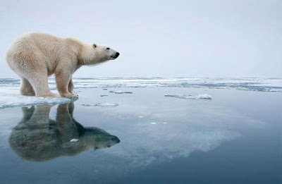
Any place that an oil spill of this magnetude would have occured would cause immense damage, but it hit one of the most vulnerable places on earth. Alaska is home to many native speices that aren't found anywhere else in the world. Along with that, the wildlife is pretty much the main source of income for the majority of the population. Many species that were depleted are still at exponentiall lower numbers 20 years later. The wildlife living off the coast of alaska is so vulnerable because they have no where else to go. Even for those species that can survive on land their was no warning, no way around the spill. A rough estimate of the number dead was .5 million seabirds, 5,000 sea otters, and 300 or so harbour seals. The communities of fish took the biggest hit with billions of salmon and herring eggs and young fish that didn't survive. With the death of these young fish, a delayed effect was seen about four years later. The fish population plumeted in '93 when the juvenile fish should have been joining the adult populations, and contributing to the new generations numbers. This really hit the vulnerable fishing industry hard, and devestated the people who based their income in fishery. The herring population still hasn't come back, and this has a negative effect on the fragile ocean ecosystem and caused the closure of the herring fisheries.

Aid was dispatched and called in immediately following the devestationg. Not just people from Exxon, but the coast gaurd, locals, scientisits, and people from the national government. Although this was almost an unforgiveable occurance, they did employ all the people and techniques for clean up that they could.

Technologies went into building the Exxon Valdez tanker in order to prevent a disaster, and those were amplified in the wake of this event. Sciece again was relied on during the clean up of the spill. Marine Toxocolgist were utalized to help survey the damage, and they used their data to determine the extent of the damage in order to mitigate the rescure efforts. Now, more than 20 years later, they have sampled water near Prince William Sound, Alaska and have still found leathal concentrations that are readily availae to organisms.

In the end this was one of the most widespread natural disasters in recent history and is still negatively impacting people today. Looking at the big picture there lessons to be learned from this horrific event. Bridging the natural habitat of the ocean - locations of ice drifiting ice sheets, location of reefs, with the technology of today can prevent another spill. It would be extrememly smart to use staellites to survey shipping lanes and then warn ships of the proper routes to use to avoid ice AND reefs. This will help prevent another oil spill and the affects it has on society.

http://www.eoearth.org/article/Exxon_Valdez_oil_spill
http://www.democracynow.org/2009/3/24/20_years_after_exxon_valdez_oil
http://www.enewspf.com/latest-news/science-a-environmental/27597-exxon-valdez-oil-lingering-in-environment-feds-say.html

Monday, October 3, 2011

The Philippines have been tormented with two Typhoons in one short week. Early last week, amidst the rising sun on Tuesday morning, Typhoon Nesat slammed the Philippines’ main island, Luzon, and its capital Manila, with winds of up to 105 mph and a massive breadth of 400 miles in diameter! Enormous waves from Manila Bay crashed over the sea wall and encompassed wide areas of the capital city. Along with the obvious flooding causing thousands to be homeless, the storm caused power outages across the country with millions still without power late last week. Nesat also caused landslides and debris deposits that blocked roads across the region.

Alfredo Lim, the city mayor, has said that flooding like this is the first of its kind to occur in Manila, and the surrounding communities, which seems to be a contributing factor as to why most of the deaths occurred in this region. An estimated 52 people were taken by the storm. This could be an eye opener for the capital city to the precautions they need to be taking during the typhoon season that they may have been neglecting up until now.

No sooner had the country felt the smallest bit of healing from the rescue effort when typhoon Nalgea hit with no mercy 2 days ago on Saturday October 1. It spent 6 hours blowing its 121 mph winds around the Main Island that couldn't possible have had the capacity to take up more water. With this second round of flooding, the indirect effects of the storm will be emphasized. It will be even more essential, but much more difficult to get enough food and water supplies to those who are isolated due to blocked roads and continuous flooding. The most extreme cases have been families who were forced to spend days on their roofs to escape the flooding. Without sufficient distribution of food, water and health care the death toll will rise.

Through all of the devastation, loss of life, and loss of livelihood, there are definite lessons to be learned. Precautions towards this kind of storm and its disastrous aftermath should be taken underway and enforced even for areas that have never personally seen it.

Below - Even cargo trains are being put into use to help evacuate thousands and thousands of people.
Children look out from the back of a delivery truck as they evacuate their shanties after floodwaters brought by Typhoon Nesat hit Baseco, Tondo city, in metro Manila on Tuesdayhttp://www.bbc.co.uk/news/world-asia-pacific-15075149 

http://www.bbc.co.uk/news/world-asia-pacific-15141169
http://www.bbc.co.uk/news/world-asia-pacific-15086050

Tuesday, September 27, 2011

Melting Ice Caps Could Spell Disaster

Global climate warming is having many detrimental effects on multiple regions of the world. One of the most harshly affected areas is the Arctic. The drastic increase of the average temperature in the Arctic is gradually causing one of the biggest natural hazards ever to plague the earth. Proof of climate change is seen in the Arctic by the major decrease in sea ice that many animals depend on for survival. This summer we saw the lowest sea-ice extent since at least 1979, and the last 5 years have been the lowest ever recorded. The survival of the entire wild Polar bear species is riding on these ever thinning sheets of ice. During the winter months they use them to hunt for food and create a store of energy they use throughout the summer where they reside on land. If the ice sheets continue to break up earlier and earlier they will not have enough time to store a sufficent amount of energy to reproduce and survive.

Humans are also being affected by the drastic melting of ice, not just in the arctic, but around the world. The glacier that covers a significant part of Greenland is breaking apart at an alarming rate. Although the breaking up of ice is a natural process, it has been increasing at very unusual rates. Looking at these rates it is getting harder and harder to dispute the idea that we are the cause of this and we are creating a catastrophic natural hazard. It has been projected that if all the major ice stores on the earth were to melt, sea levels would rise 200 feet. When taking into consideration what cities are on the coast, this is heavy information. The megalopolis along the East coast of the U.S. along with the major cities of New York and Los Angeles would all be under water and would have a detrimental affect on the U.S. and the world, not just with loss of life but with loss of information and technologies. 

The melting ice gives us a small look into the future and it seems to be a warm and gloomy one as long as we don't make an effort to reduce our carbon emissions and other contributions that are catalyzing global warming. The melting of the arctic ice is just the beginning of a waterfall of natural hazards.


http://www.telegraph.co.uk/earth/earthpicturegalleries/8204241/Polar-bears-could-be-saved-by-a-big-enough-reduction-in-greenhouse-gas-emissions.html?image=1

http://www.time.com/time/health/article/0,8599,2095114,00.html

http://content.usatoday.com/communities/sciencefair/post/2011/02/polar-bears-population-decline-arctic-sea-ice-global-warming-climate-change/1

http://today.msnbc.msn.com/id/44353322/ns/today-today_news/t/second-giant-ice-island-set-break-greenland-glacier/#.ToKjUtTbxPw

Tuesday, September 20, 2011

Himalayan Earthquake Leaves Thousands Homeless on a Rainy Night

A 6.9 magnitude earthquake hit the Himalayan region of India, Nepal, and Tibet on the evening of Sunday September 18. The quake caused a massive domino effect of more than 100,00 collapsed houses and various mudslides that cut off power, water and other utilities to thousands of people. This made rescue efforts by helicopters and earth movers, and military extremely strenuous and communication with most villages unobtainable. Intense rains occurred and made the relief effort near impossible for a period of time, and left the homeless out in the stormy weather for a cold and miserable night.

Thousands of people are currently homeless and others are choosing to stay out of their homes for fear an aftershock will cause them to collapse. At least 5 aftershocks have been recorded so far. The Seattle Times reported that in Gangtok, India many of the residents are taking shelter in the open areas at the University and soccer stadium to protect themselves against these aftershocks. The death toll was reported to be 81, but will continue to rise as rescue workers reach villages that have been cut off by the disaster.


http://seattletimes.nwsource.com/ABPub/zoom/html/2016261501.html


http://www.google.com/hostednews/ap/article/ALeqM5iX2jeXsAw-L5eNjWO_uWTss_glhA?docId=1fbea8b8514845efb5e0372d048c4412


http://seattletimes.nwsource.com/html/nationworld/2016258727_apasindiaearthquake.html

Thursday, September 15, 2011

Drought Stricken Texas Still Feeling the Heat

Texas has had the hottest and driest summer ever recorded. The drought has been a catalyst for water shortages and wildfires. Many cities and towns are preparing for a problem they have never been faced with before - they are running out of water. Multiple towns already have placed restrictions on water use to the point where nothing more than using it for drinking, bathing, and business is allowed. The drought has brought a number of recent wildfires to the region. One that has been traveling across the Texas for the last few days has taken with it almost 800 homes, which doesn't even compare to the one that roared through Magnolia, Texas and destroyed more than 1,600 homes earlier this summer. Along with battling the heat, many Texans that are displaced by the fires are trying to put the pieces of their homes and lives back together. 

The drought has had a monumental impact on the agriculture of the region. MSNBC reported that in the state of Texas agricultural loses have risen above $5 billion. With Texas being the nations second largest agriculture state one can imagine the impact this has had on many families and businesses.

In the last few days meteorologist have not had much good news for the scorched region. The recent return of La Nina does not bode well for Texas' and surrounding states. This weather system means that the warm and dry temperatures will most likely be expected to continue through December. 


http://www.msnbc.msn.com/id/44534812/ns/weather/#.TnK7MtSLPOo
http://www.huffingtonpost.com/2011/08/18/texas-drought-2011-town_n_930308.html
http://www.climatecentral.org/news/record-breaking-texas-drought-and-heat/

Tuesday, September 13, 2011

Tropical Storm Katia Hits Ireland & Britain

The media lately has overloaded us with coverage of hurricane Irene, which hit the East coast of the United States late this summer. Other less publicized tropical storms have also been wreaking havoc this season. Tropical Storm Katia hit the shores of Britain and Ireland on Monday. The storm slammed the countries with the strongest winds they’ve experience in 15 years.The Associated Press reported on Monday, September 12, that only one English man was killed when a falling tree hitting the car he was driving. Tens of thousands have lost power and winds of up to 74 mph caused even more monetary damage to ferry and rail systems. Katia also brought rains that caused damaging coastal flooding. Although Ireland and Britain seem to be in the clear, "Norway, Sweden and Denmark said they expected gale-force winds to arrive there Tuesday."


http://old.news.yahoo.com/s/ap/20110912/ap_on_re_eu/eu_europe_tropical_storm